When researching the Caribbean, it doesn’t seem that many sources are a truly inclusive source. In fact, they tend to focus on a particular area of the Antilles and go forth full throttle. When coming across The Public Archive, my hopes were high that I might find a site with all kinds of information pertinent to the history of the Caribbean.
Indeed, this site has an outstanding Blogroll right under a hyperlinked Word Cloud on it’s about page (and most of its pages in fact). With an inclusion of such sites like CieloNaranja that focuses on Dominican Republic festivities to African Diaspora PhD, I had expected this site to be interested in more than one area. But a quick read through the About page debunked this belief; the site claims “The Public Archive was initiated to serve as an accessible clearinghouse of historical essays, archival sources, and informed contemporary journalism on Haiti.” Now it makes sense that this would be their mission following the Earthquake in 2010, to provide a digital resource that won’t easily be destroyed by physical tragedies. However, The inclusion of certain sites made me question their direction, and I’m thoroughly disappointed.
This does not mean that as a Haitian archive, the site doesn’t serve it’s purpose. In fact, it’s important to look at DR history when looking at the history of Hispaniola, where Haiti calls its geographic home. In particular, I found fascinating the Interviews page that has transcribed various interviews with such people like the former American Secretary of Defense, Donald Rumsfield, Barnard Professor Kaiama L. Glover, and Historian/Author Hans R. Schmidt, all discussing various topics within Haitian History of war, rebellion, colonization, etc.

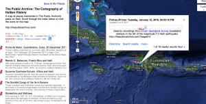
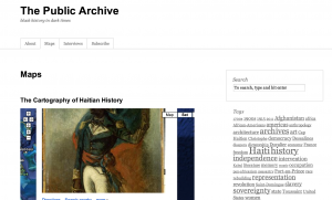
After looking at this page I was certain the Maps page would be interesting and a great source. However this is where the site let me down. I was excited for its interactive Google Map with pins that one can click on for more information about certain geographical locations in Haitian history. But once you click on a push pin, on this site, within the map, the pop-up is far too large to be legible or even explored. You must in fact click the link that takes you to the larger indexed map to even begin to enjoy this Cartography. However, even here, some of the images are too large, so the only way to truly view this comfortably is to zoom out of the page and click from the left side option panel. The Map also focuses solely on Hispaniola, while various of the push pins are from various places through the world, including France. So one must zoom out of the map to see all these places. On top of that, some of the locations lack a picture and instead have lovely question mark within a blue box. Clearly this needs to be fixed.
Overall, I very much admire the kind of work the creators of Public Archive put towards this project. It must’ve taken a whole lot of work to achieve a site that includes such an amount of information on Haiti. However, I was highly disappointed with the navigation of one of it’s main pages: Maps. This interactive feature seemed like it would just take the site to a whole other level its its Cartography of Haitian History, but in fact, it was VERY frustrating to use and extract much information from.


I agree with you in being disappointed in the Public Archive’s map feature. It seems a little clunky and I had a hard time properly navigating it at first, but I think it’s a good utilization of Google Maps for a website and helps to add some interactivity to the site. I would consider the next step to be something like the map on the 1760 Jamaican Slave Revolt’s website, but it shows that one can use something that is already available and reuse it for specific purposes. Perhaps if they had a forum section, people would be able to suggest changes or even offer up tidbits of information with links and/or pictures that the website owners could integrate into their map.