(Image taken from http://withfriendship.com/user/neeha/slave-rebellion.php)
Slave Revolt in Jamaica, 1760-1761 is a website that encompasses an animated thematic map that narrates the spatial history of the greatest slave revolt in the eighteenth century British Empire. Vincent brown, Charles Warren Professor of American History and Professor of African and African-American Studies from Harvard University is the principal investigator and the curator of this site. For researchers, this site is intended to be a catalog of documented evidence that speaks to the tactics used by the members of the uprising, particularly their use of the natural topography of the island to gain strategic advantages over the British military and their sympathizers.
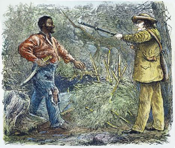
On April 7th, 1760 in the midst of the Britain’s Seven Year War (1756-1763) against France and Spain, some fifteen hundred slaves on the island of Jamaica stage a massive violent “uprising.” This began in the Parish of Saint Mary and eventually spread to neighboring parishes. This site attempts to answer the questions, “was the revolt a unified and coordinated affair, or was it instead a series of opportunistic riots? What in fact did the rebels hope to achieve? Was there ever a real danger to the British Empire in America or was the threat blown out of proportion by panicked whites? If the insurrection was as well planned as the colonists feared, why didn’t it succeed?”
In his mission to answer the above questions, the curator uses a multilayer interactive map of the Island of Jamaica. This map traces the rebel’s location overtime and in relations to the British military and Maroon militia. To create this interactive map several eighteenth-century maps were essentially combined to make the represented terrain and estate map. This terrain and estate map is use as the base for the narratives of each phase of the revolt. The narratives that are offered begin with a location marker and narrative that represents where “the Conspirators on Frontier estate decide to launch the revolt,” while the final narrative and location marker represents the end of the uprising with the capture and executions of most of the rebels by October of the following year. Between these two location markers “five hundred black men and women were killed in battle, executed, or committed suicide. Another 500 were transported from the island for life [and the] colonists valued the total cost to the island at nearly a quarter of a million pounds.”
There are four elements of this site that I found to be quite appealing, these are the base map, the locational database, the symbol design, along with the user interface. The curator describes these four elements as the “four elements [that] provide the principal content of the narration.” Firstly, I find the multilayer interactive map to be very inventive and resourceful. The curator used limited historical data to build a topographical map that highlights the positions and movements of the rebels, the British military and the Maroon militia throughout this conflict. The locational database was essential to understanding the movements of each party and decisive in the assumption that the rebels were strategic in their movements. Symbology is used to give the viewer some level of clarity as to what party was performing a certain action at a certain spatial time. Also, I find that the user interface design is quite simple and uncluttered. This is perfect for the nature of the material, which is more scholarly. Simplifying the interface allows the viewer to focus more on the content rather than the platform.
On a side not, another aspect of this site I found interesting is the curator’s use of language. In describing the revolt he uses the term “uprising,” “insurgency” along with “counterinsurgency” and “insurrection.” For me these terms when used in contemporary context are used frequently in descriptions of conflicts in the Middle East. I wonder if the choice of these worlds were intentional for the curator. Is he drawing some kind of ideological comparison between the past slave revolts and contemporary military conflicts or was he just utilization military terminology as this conflict essential involved the British military.
In all, this site is a good resource for scholars, students and laymen alike. I appreciate very much that the curator points out areas of “Uncertainty” in his argument. He admits that there are limitations in plotting a turbulent slave revolt. This rebellion was reported on by the British, who by all accounts, had no motivation to catalog a fair and balanced accounts of the events that took place during the uprising. Additionally, maps that were used in the creation of the interactive maps came from sources that could and mostly likely have some erroneous information, but with that being said, the curator was able to piece together events, from written documentation, maps and topographic evidence he gathered. Finally, by using all the information gathered the curator concluded that the Islands topography influenced the uprising, in that it allowed the rebels certain strategic advantages. He states that “from the cartographic evidence, it appears that the insurrection was in fact a well-planned affair that posed a genuine strategic threat, checked ultimately by an effective counterinsurgency” of the British military with the aid of the Maroon militia.